Blog by Fernando Monge: “In 2020, Wellington’s city council decided to map 16 kilometers of the city’s streets using GPR and Lidar technologies. They were astounded by what they found. Just in that relatively shorter mileage they identified 100 anomalies – including a collapsed water main. This pilot and an additional study gave them the justification they needed to secure the resources – 4 million dollars from the central government – to launch the pilot for an underground asset map.1
Identifying a need and getting funding to tackle it is one thing. Coordinating across the infrastructure sector is another. Aware of the importance of collaboration for the project’s success, the city council established a technical reference group with representatives from the city, the water entity, electricity and gas distributors, telecommunication providers, contractors and other experts.
Another core piece of the governance framework was finding a neutral entity that would manage the register. This is key in any data sharing scheme. Companies and public entities sharing the data want to trust that whomever is receiving their data will not share it with anyone who shouldn’t have access to it. They also need to be confident of technical security aspects. In the case of the UAR, this intermediary role was played by Digital Built Aotearoa, a neutral not‑for‑profit entity that operates the platform and runs a federated data sharing scheme, ensuring that no one single entity controls all the data.
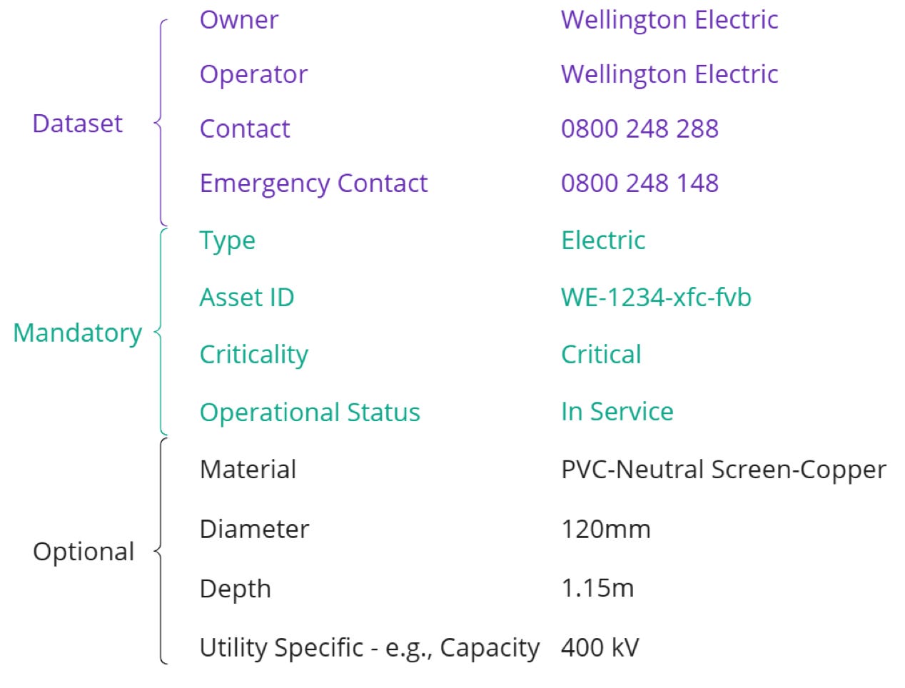
Through this collaboration process – one of the most interesting aspects of the UAR’s experience – partners agreed on the type of information, standards and sharing mechanisms of the UAR. For example, assets’ attributes such as type (water main, sewer, power cable…), ownership, dimension, material, installation data and positional accuracy need to be included in the register. Metadata also describes how each dataset was collected, its refresh rate and usage constraints. See an example of some of the data collected per asset:
The quality of the data is determined based on whether it was derived from existing records or precisely surveyed. Asset owners share it with the platform through APIs or file uploads. Field crews of asset owners or construction companies can also share data directly via a mobile app when they find something while digging…(More)”.