NASA Harvest: “Have you ever thought about how scientists keep track of what is happening all over the Earth? Thanks to satellites orbiting high above us, we have eyes in the sky that capture vast amounts of information every day. These satellites monitor everything from sprawling forests and melting glaciers to tiny fishing boats and fields of crops. But turning this endless stream of satellite data into meaningful insights is a big challenge. That is why a team of researchers from NASA Harvest, the Allen Institute for AI (Ai2) and partner organizations set out to create a smarter solution.
Their new study, titled “Galileo: Learning Global & Local Features of Many Remote Sensing Modalities,” was recently published and brought together experts from across the globe. The team aimed to build a tool that could make better sense of all the different types of satellite data we collect so we can make more informed decisions to protect our world.
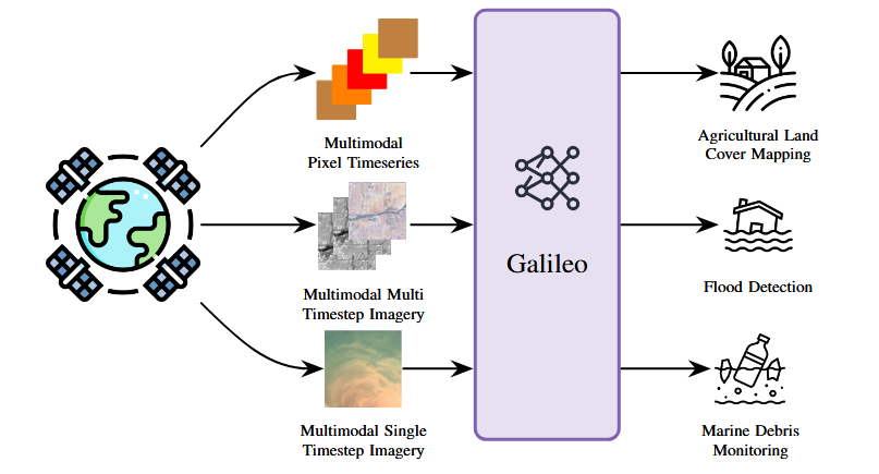
Why is this research so important? Because satellites do far more than take pictures from space. They help farmers decide when to plant and harvest crops, track how fast glaciers are disappearing, monitor floods, and even detect marine debris floating in the ocean. However, satellite data comes in many forms, like optical images, radar scans, and climate measurements. Until now, most computer models could only handle one type of data at a time. This meant scientists needed separate systems for each problem.
Enter Galileo. This new artificial intelligence (AI) model was designed to process many kinds of satellite data all at once. Even more impressively, Galileo can detect both large-scale patterns, like glaciers retreating over decades, and tiny, short-lived details, like a fishing boat appearing for just a day. By learning to recognize these patterns across multiple scales and data types, Galileo gives researchers a more complete view of what is happening on Earth.
The team found that Galileo outperformed older models that were specialized for just one kind of data. With Galileo, scientists can now use a single model to tackle a wide range of challenges. These include mapping agricultural land, detecting floods, and monitoring marine pollution. It is a powerful step toward making satellite data more versatile and accessible…(More)”