Devin Coldewey at TechCrunch: “A new map of nearly all of Africa shows exactly where the continent’s 1.3 billion people live, down to the meter, which could help everyone from local governments to aid organizations. The map joins others like it from
It’s not exactly that there was some mystery about where people live, but the degree of precision matters. You may know that a million people live in a given region, and that about half are in the bigger city and another quarter in assorted towns. But that leaves hundreds of thousands only accounted for in the vaguest way.
Fortunately, you can always inspect satellite imagery and pick out the spots where small villages and isolated houses and communities are located. The only problem is that Africa is big. Really big. Manually labeling the satellite imagery even from a single mid-sized country like Gabon or Malawi would take a huge amount of time and effort. And for many applications of the data, such as coordinating the response to a natural disaster or distributing vaccinations, time lost is lives lost.
Better to get it all done at once then, right? That’s the idea behind Facebook’s Population Density Maps project, which had already mapped several countries over the last couple of years before the decision was made to take on the entire African continent….
“The maps from Facebook ensure we focus our volunteers’ time and resources on the places they’re most needed, improving the efficacy of our programs,” said Tyler Radford, executive director of the Humanitarian OpenStreetMap Team, one of the project’s partners.
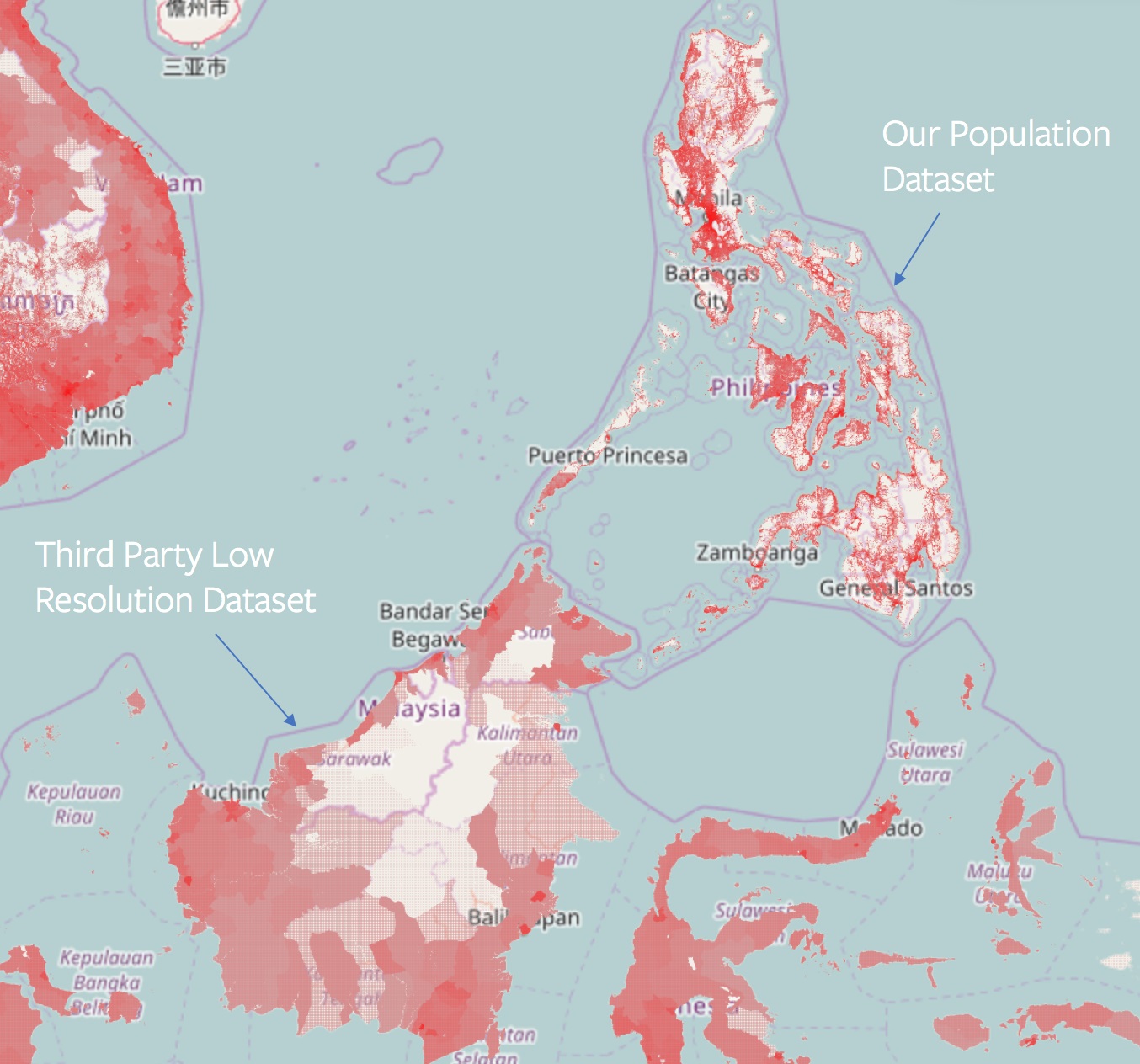
The core idea is straightforward: Match census data (how many people live in a region) with structure data derived from satellite imagery to get a much better idea of where those people are located.
“With just the census data, the best you can do is assume that people live everywhere in the district – buildings, fields, and forests alike,” said Facebook engineer James Gill. “But once you know the building locations, you can skip the fields and forests and only allocate the population to the buildings. This gives you very detailed 30 meter by 30 meter population maps.”
That’s several times more accurate than any extant population map of this size. The analysis is done by a machine learning agent trained on OpenStreetMap data from all over the world, where people have labeled and outlined buildings and other features.